Custom Search
Showing posts with label pano. Show all posts

Thursday, June 16, 2011

Oak Bay Panorama

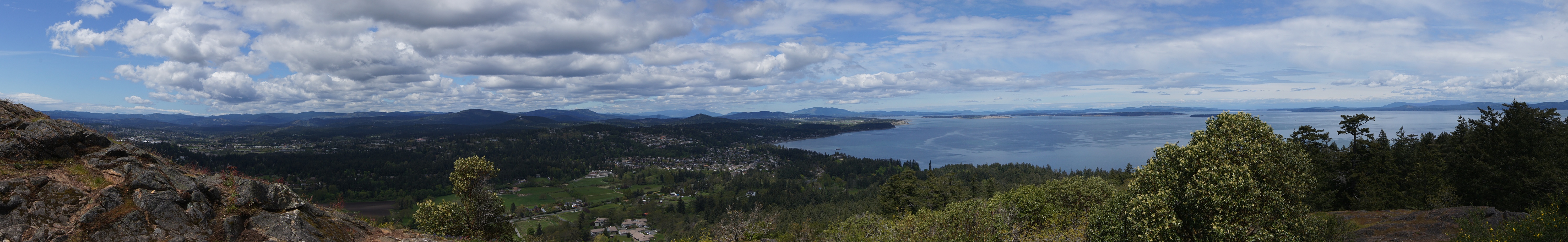
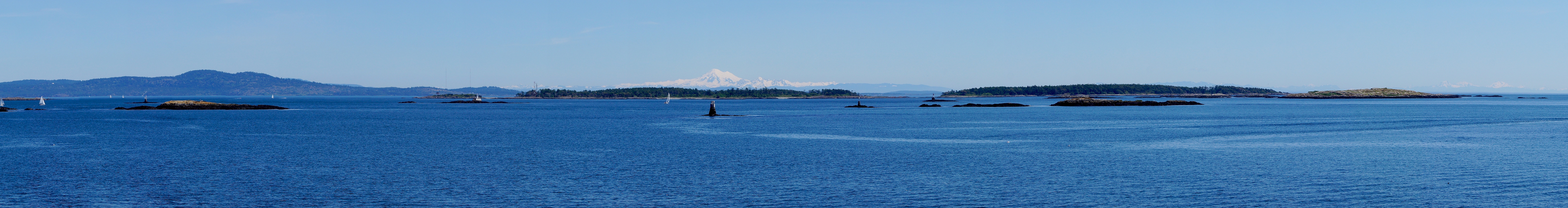
Last week after enjoying the Oak Bay Tea Party parade I rode along the beach front past the Oak Bay Marina and I had to stop when I looked out over the water and saw this panorama. I realized that it was the perfect time to try out the panorama feature of my new camera. This is the result. If you click the photo above you will be taken to the half size original which, 6400 pixels wide, is still pretty big. You may have to click it again to see it full size since it may be larger than your screen. I'm pretty pleased with this feature. It's easy to use (just pan the camera with the shutter release held down) and the stitching between frames is invisible. That perfect snowy peak in the distance is Mount Baker, an extinct volcano about 80 km east in the USA.


As visitor Paul in Powell River points out, Mount Baker is NOT an extinct volcano but is in fact the second most active volcano in this area, the most active being Mount Saint Helens. My thanks to Paul for this correction. See this entry in Wikipedia for more information about Mount Baker. If you want to see some beautiful photos of the Sunshine Coast, take a look at Paul's photoblog, A Powell River Photo Blog. I am particularly fond of his header photo of some Harlequin Ducks in flight.

Sunday, May 2, 2010

Mount Douglas Panorama II

Yesterday's panorama from Mount Douglas was taken looking northward up the east coast of the island. Today's panorama is looking south with the city of Victoria spread out beneath us, the Strait of Juan de Fuca beyond it and the Olympic Peninsula (USA) on the opposite shore. Stretching out to the right is the west coast of Vancouver Island. (Click the photo to see the larger version, which you may have to click again to see full size.)

Saturday, May 1, 2010

Mount Douglas Panorama

The summit of Mount Douglas provides an excellent view of the southern tip of Vancouver Island. Here we are looking northward with Cordova Bay directly below us and Sidney Spit and some of the Gulf Islands beyond. Most of what's on the right are the San Juan Islands of the USA. This pano is quite large - click it to see the full size version. (You may have to click it again depending on the browser you use and the size of your monitor.)

Tuesday, April 13, 2010

It's All a Matter of Scale

Only a few steps up the hill from the site of yesterday's photo I took the series of 16 photos that make up this panoramic view of Victoria from Highrock Park. It's about an 180 degree view from Mount Douglas on the left to Odgen Point on the right. Click the small image above to see the large version. You may have to click the large version again to see it full size. Once again, credit must go to the developers of Hugin, which software did the seamless stitching of the 16 photos that make up this panorama.

Saturday, March 27, 2010

Laurel Point Panorama

The day before yesterday I posted a few photos taken from Laurel Point. Here is a panoramic view of the Inner Harbour from this location. Click the photo to see a larger version. You may also need to click the larger version to see it full size.

Wednesday, December 30, 2009

Inner Harbour From Johnson Street Bridge

Here's a little panoramafrom 5 photos stitched together with Hugin. (Hugin is free and easy to use if you want to play with it.)

Saturday, October 17, 2009

Ross Bay Panorama 2

Here's another panorama of Ross Bay that is more inclusive although it is smaller and less detailed. The previous Ross Bay Panorama was shot with a 90mm lens and is composed of about 8 or 10 separate photos. This panorama was shot with a wide angle lens at 10mm and is composed of 3 separate photos. I think I like it better since it encompasses all of Ross Bay with the tip of Clover point just visible to the far right.

Tuesday, October 13, 2009

Ross Bay Panorama

The shoreline that defines most of Victoria is a scalloped in a series of "bays" with "points" separating them. Here I am standing on Clover Point and looking towards Ross Bay. The large green area on the left is the Ross Bay Cemetery. The Island on the far right is Trial Island. Click the above photo to see the large version where you can scroll from side to side. You may have to click the large version also in order to see it full size.

Friday, October 2, 2009

Another Panorama

panorama, Songhees Point, Victoria, BC, CanadaI am still enjoying these big panorama shots. Here's one that is just about 360 degrees, taken from Songhees Point. These big panoramas are not difficult to make with the great software that is now available. I use a free open-source software called Hugin which you can read about and download from HERE. As with the other BIG panorama I posted earlier, you need to click this one to see it big and you may have to click the big version again to blow it up as well.

Saturday, September 12, 2009

Panoramic View - Johnson Street Bridge to Laurel Point

Take a stroll around Victoria's Inner Harbour by clicking on the tiny pic above. You will then see a panorama 16 megapixels wide. You may have to click it again to see it full size. Then you can scroll from one side to the other. This panorama is 18 separate photos stitched together. My apologies to viewers with a slow internet connection - this photo may take a while to download - it's HUGE. But if you wait for it I think you will enjoy.

Wednesday, September 9, 2009

Big Picture

Bayview Residences, view, panorama, downtown VictoriaHere's another photo from my visit to the 9th floor of the Bayview Residences in Vic West. This one is two shots stitched together for a little more panoramic view of downtown Victoria. Click the photo to see a larger version.